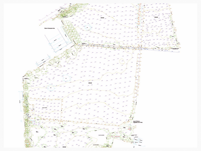
Topographical Survey.
Skilltran produces highly accurate and detailed topographical surveys, from green field sites to urban environments.
We have the expertise, the latest GPS technology, Robotic Stations and data processing software to provide you with the depth of digital detail and can present the final drawing in any format that you desire.

GPS Services
Through the use of the latest GPS Survey equipment from Leica Geosystems, Skilltran is able to provide you with highly accurate and presice data in OSGB36 (National Grid), WGS84 Global or local Grid Coordinates.
GPS Surveys can be undertaken to link with any asset data or related information with OS Coordinates.
Using RTK Smartnet techniques we can provide real time results or if greater accuracy is required,
post processing is carried out on dedicated GPS software.
The Old Bakehouse, 44a Western Rd, Hurstpierpoint, BN6 9TA-West Sussex T: +44(0)1273 835235 | M: +44(0)7973 744118 | F: 01 273 832 526
W: www.skilltran.co.uk | E: office@skilltran.co.uk
Website desing by Skilltran 2015.
